Video examples of the use of drones as technical solutions
by the members of the HOSIHO Drone Network.
All our UAV pilots are available for any kind drone assignement in France, either artistic or technical, since the network brings together skills for a very wide range of applications with UAVs :
- Quarry inventory by drone
- Thermography by drone
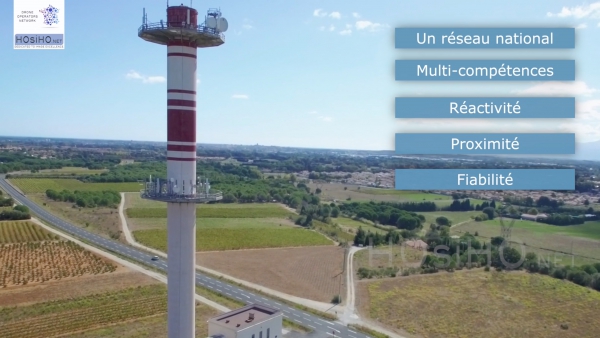
- Inspections of aerials and pylons by drone
- 3D modeling of buildings / monuments by drone
- Photogrammetry and topographical surveys by UAV : The introduction of light aerial means into topographic surveys requires a good understanding of the entire measurement and data production chain. With 5 years of experience in photogrammetry, DRONE HORIZON Technologie carries out its technical missions with the help of a surveyor or an expert in civil engineering to guarantee consistency between aerial capture, plan production and their conformity with reality .
Ground beacon, RTK GPS system, LiDAR, Total station or automatic cross flights,… are some examples of the means available to produce and digitize surfaces or volumes in a coherent manner. What is decisive is the ability to appropriately define each of these technical means in relation to the configuration of the site, the type of infrastructure to be covered or the administrative and aeronautical procedures required.
Thanks to the use of powerful photogrammetry software such as the Pix4D suite or Metashape tools, the digital renderings are varied: Ortho-photomosaic, georeferencing of assemblies, Dense point cloud, Digital Terrain Model (DTM), 3D textured model, conditioning of data for Geographic Information Systems (GIS) or plan output in AutoCAD format.
But the main thing in aerial imagery is to have consistency in all the 2D / 3D acquisition, processing and rendering chain between three determining parameters for any photogrammetry project.
- Resolution (from 0.5 mm to 3 cm)
- Precision (from 3 to 15 cm)
- The establishment of a reference system and controls of deliverables
Latest innovation from DRONE HORIZON Technology, capturing, assembling and producing digital data with thermal aerial shots.
- Inspection of engineering structures by drone: For 3 years Dragonfly has carried out technical missions for specialized companies, insurers, prime contractors, architectural agencies, which process and analyze the images captured by drone. Whether managed by the State, the Departments, the municipalities or the motorway companies, the structures represent a considerable heritage, the economic and security challenges of which are very important. Also to maintain the level of service of a structure, guarantee the safety of users and optimize maintenance work, the manager must carry out with precision his diagnoses and know the real pathology of the structure. These structures are the subject of systematic surveillance actions which include routine visits, sometimes annual, in order to identify faults, major or minor (damaged safety barriers, blocked drains, cracks, etc.) and check the evolution of disorders identified during previous visits. Sometimes, detailed inspections may be requested to look for all of the anomalies, especially in inaccessible areas.
Drone inspection can answer several challenges:
- Improves the accuracy of the qualitative and quantitative information found on the works, by the use of images, films and photos
- Allows inspection as close as possible to the building, at different heights. The drone's maneuverability makes it possible to take shots from several angles, ensuring a good understanding of the damage observed;
- Reduce human and material risks, especially when it comes to working on sensitive elements (roofs, concrete crowns of water towers, control of bridge structures, inspection of pylons, etc.);
- Intervene quickly and at a reduced cost of implementation.
Note: insurance companies very often use drones for their diagnostics. It provides detailed aerial photos and can be used both for prevention and for intervention in any type of disaster, especially in polluted or dangerous places.
- Phenotyping in agriculture, by drone: For 3 years now, DCOMDRONE has carried out technical missions on behalf of companies specialized in the processing and analysis of aerial data by multirotor drone. Their expertise leads them to use sensors for visual imagery (RGB), multispectral imagery and thermal imagery. They know the different processes specific to each sensor, their operation, the necessary settings and optimum operating conditions to guarantee the recording of quality data that can be used in the post-processing phases. For this type of mission, the remote pilot must generally implement automatic flights which again require a lot of rigor in the settings useful for the planning and execution of flights. See the article on the drone serving high speed phenotyping. Beyond this very technical know-how, DCOMDRONE, like each of the operators of the HOsiHO network, is fully aware of the regulations and all the rules applicable to our profession in the areas of both administrative and aviation safety.
- Air quality measures with a UAV : Here is an application that has a future at a time of climate change and collective awareness about environmental issues. An example of air quality measurement conducted by our member Drone-Pictures, based in Provence, in Marseille, is detailed in this article. It describes the progress of a campaign to measure the pollution emitted by ships cruising in the ports of Marseille and Fos-sur-mer, in France, thanks to technical and scientific collaboration with the Finnish company Aeromon Oy, inventor and manufacturer of modules. light gas measurement devices, the BH-12, on board by drone. These air sensors / analyzers are a revolution for the environment, and all the pilots of our network have been able to benefit from this expertise in developing flying solutions based on the Dji M200 drones.
Check their respective presentation page and find out more about the exact service they can offer.