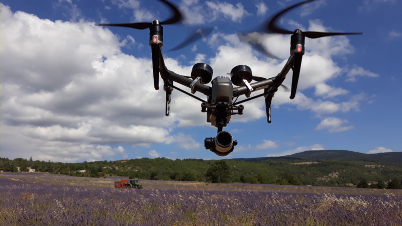
Inspire 2 Uav flying over lavender fields, Sault, during the harvest on July 18, 2020 © Drone-Pictures
It all started early 2020, before the health crisis linked to Covid-19.
For the needs of filming in preparation for the France episode of season 2 of the documentary series Europe From Above, broadcast on National Geographic (NatGeo), the London-based production company Windfallfilms began searching for aerial sequences using drones that had already been shot and were available in stockhots. This is how they find their happiness in the HOsiHO collection, the aerial image bank to which we have been contributing since the beginning in 2014. A contact was then established in view of this important project.
It was back in February, and the first intention of the producer of the series was to shoot with his own teams, in France and in Europe, drone and ground footage, in spring and summer, as they had done until then for the first season of Europe seen from the sky!
Their need? Beautiful images of France in Autumn, especially landscapes in Normandy, Aquitaine, Provence and the Alps.
Then came the time of the global pandemic, of containment and the initial plans all had to be reviewed according to health constraints. So there was no longer any question of international teams travelling from one country to another. National Geographic & Windfallfilms then had to recruit cameramen, assistants and drone pilots near on location as close as possible to the planned filming locations.
Thus, at the end of May, through HOsiHO Drone Network, we were hired for a whole series of drone shootings in Provence, with precise and rather particular technical and artistic requirements.
Since drone filming has been our business for more than eight years, we are used to taking up challenges, adapting and always providing our customers with the drone flight service that exactly meets their expectations. This is the least you are entitled to expect from Drone-Pictures and the other french UAV operators who are members of the HOsiHO network of drone telepilots.
On the technical side, NatGeo required to deliver the video rushes in the Prores422HQ native shooting codec, so the choice of the drone was obvious with our Inspire 2 and its Zenmuse X5s camera, accompanied by a range of prime lenses lengths from the Olympus Zuiko range, from 24 to 90mm (35mm equivalent). However, since all drone flights were in the open Nature, we have expanded this range of lenses with the acquisition of LAOWA's super-wide-angle 7.5mm F2.
On the artistic side, apart from the creativity and the basics of the cameraman/photographer's job, i.e. capturing landscapes with beautiful light, at the best angles and filming in a fluid way, we had to take into account a specific need: to be in the same place 2 or 3 times in the space of several weeks.
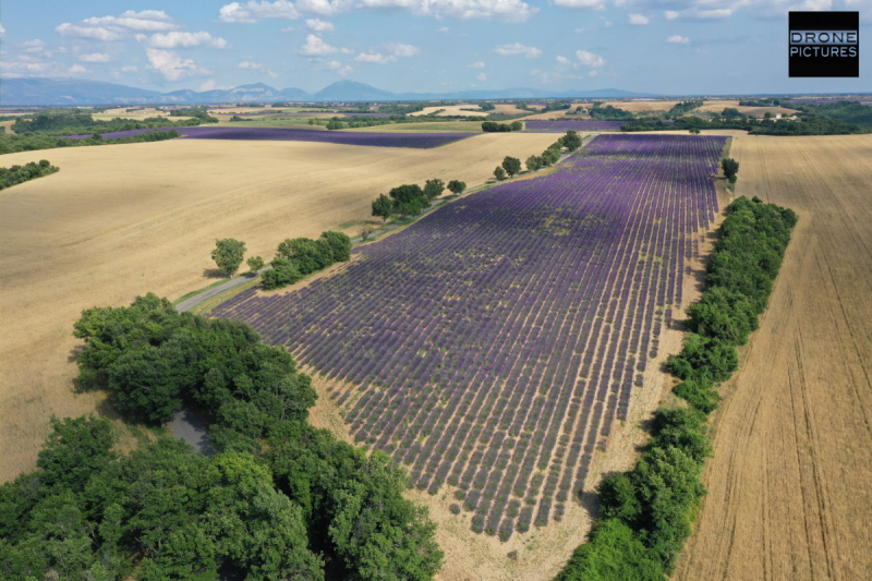
Aerial view of the blooming lavender fields in Provence, July 1st towards Sault, Vaucluse © Drone-Pictures
An example? The lavender fields on the Sault plateau in the Vaucluse.
It was necessary to fly over the same field three times and repeat exactly the same five overflights of the field requested by the director, at three significant periods: before the lavender flowered (mid-June), then the field in full bloom with intense colors (early July), then the day of harvest (mid-July).
For what purpose did we fly over the same field at 3 distinct periods?
To provide the editor with the same shots of the lavender field so that he can fade them in and out and thus illustrate the notion of time and the passing season, of nature changing. These shots are called "Transition Shots" by the Anglo-Saxons. Except that despite our countless experiences and the diversity of our UAV shots since 2011, we had never before practiced the repetition to the millimeter of a UAV overflight in the same place, same parameters.
Thanks to our HOsiHO Drone Network's colleagues, we quickly found a reliable and precise way to schedule these drone flights as precisely as possible, to modify the parameters on site if necessary, and to be able to repeat them as often as needed according to the requested date. We used the Litchi application on iPad, and especially appreciated the ease of programming these flights via their online Mission-hub, which allows us to place our waypoints on a Google Map and indicate all the extended settings for a UAV flight, such as : altitude, camera tilt angle, aircraft speed, GPS waypoints, UAV heading, etc., as you see on the following screenshot :
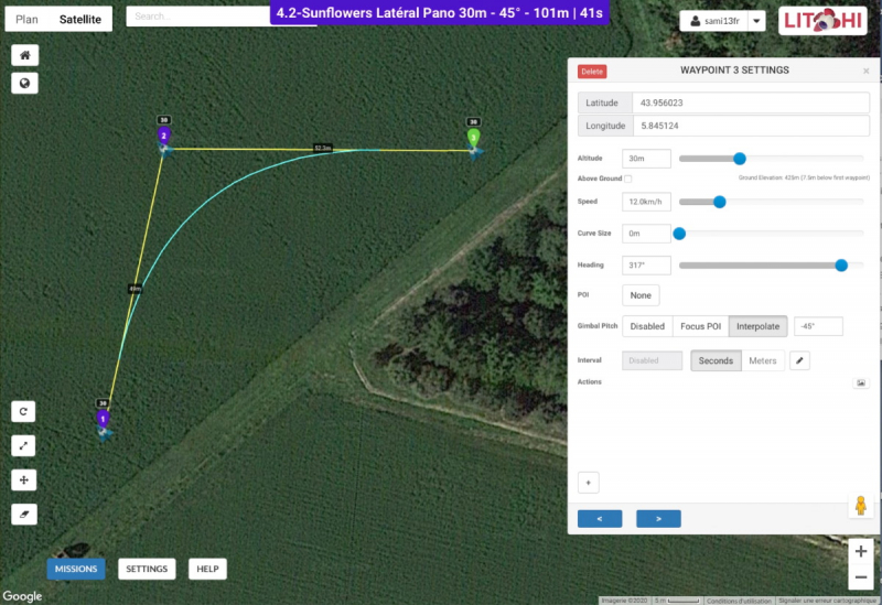
UAV flight programmed via Litchi's Mission Hub - Overflights of a sunflowers field in Vaucluse, France
Thus, most of the drone flights could be done in reduced manpower, i.e. the pilot alone, for health reasons.
However, this rule had to be waived twice because it was impossible to take beautiful images in complete safety with the pilot at the controls in solo mode during the drone shoot at the Millau Viaduct and on the day of the lavender harvest, because in both cases, it was a question of following an action, or a tractor, with a long focal length (50 and 90mm), in order to bring back spectacular images as close as possible to the filmed subject.
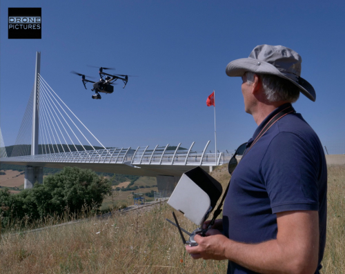
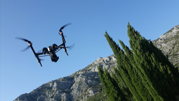
Telepilot with the Inspire 2 drone in flight at Millau Viaduct, Aveyron, France © Drone-Pictures
For these 2 cases, the brittain production company understood perfectly the imperative and made it its own to convince the American television channel NatGeo of the merits of this team, indispensable for the proper production of the aerial images required, despite the 'covid-19' risk still present in France at that time. Nevertheless, we had to respect the barrier gestures and social distancing, and answer a medical questionnaire beforehand.
In the end, for this documentary, which will be broadcast in 2021 on the Disney+ platform, we flew over no less than twenty sites spread out from the Vercors to the Montagne Sainte-Victoire, from sunflower fields to the lavender fields of Sault, from the Pont de Millau to the villages bordering the Tarn in Aveyron, we were filled with colorful images, gorged with the generous sunshine of our beautiful southern region.
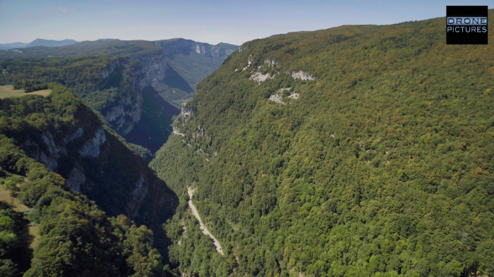
Aerial view taken by drone of the Gorges de la Bourne in Vercors, France © Drone-Pictures
We are proud of it because the images have much more to offer to the production and the director.
But we are also happy to have met welcoming people like Farid and Evelyne who have been farming lavender fields in Sault for so many years, or Eric, a farmer from Pierrerue who confided the secrets of the Sunflower to us!
So thank you to them, to Eiffage for its welcome and the availability of its teams for filming on the piers and pylons of the famous and spectacular Millau Viaduct, and of course to our customers and interlocutors who are always available and fantastic, at Windfallfilms.
More than you, we can't wait to see the French episode of this second season of Europe From Above !
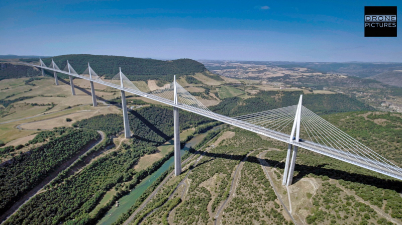
Aerial view of Millau Viaduct and Tarn river, viewed from drone - Aveyron, France © Drone-Pictures
Below is the schedule of our drone assignements for Europe From Above, Season 2!
August 12th: In the Vercors (Gorges de la Bourne) and at the foot of the vineyards of Sainte-Victoire mountain (towards Puyloubie)r at the Domaine de Saint Ser, that we thank for the warm welcome)
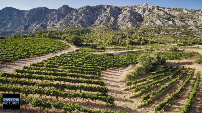
Aerial view of the vineyards at the foot of Mount Sainte-Victoire © Drone-Pictures
July 24th: Viaduct of Millau, Tarn valley and village of Peyre, in double-operator on drone Inspire 2 + X5s in ProRes + 4 focal lengths (from 7.5 to 45mm) during a technical intervention of Eiffage, at the top of Pylon #2 (the highest at 345m)!
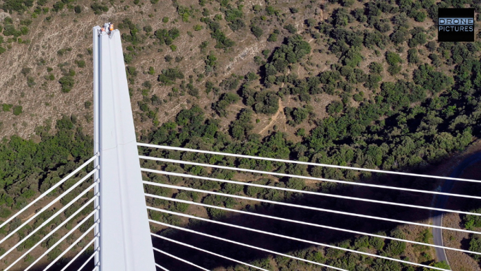 Aerial view of Millau Viaduct P2 pylon during a technical intervention, filmrf by drone - Aveyron, France © Drone-Pictures
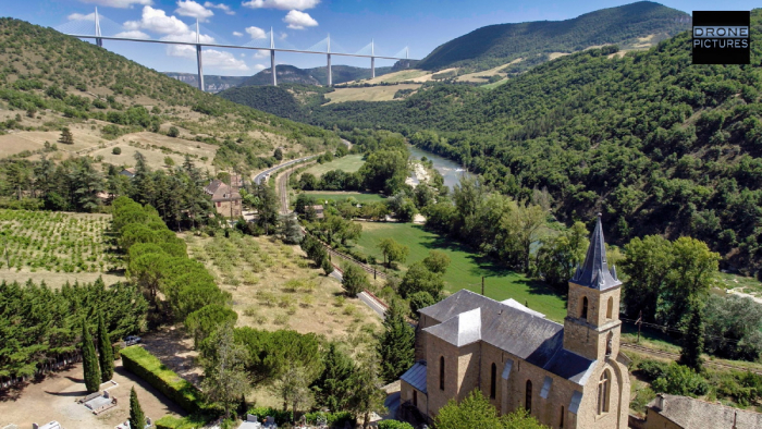
Aerial view of the Millau Viaduct from the church of Peyre, shot by drone - Aveyron - © Drone-Pictures
July 18th: Thirrd and last passage on this wonderful plateau of Sault in Vaucluse for the documentary series Europe From Above by NatGeo. Ideal weather conditions and an unobstructed view of Mont-Ventoux.
July 9th: First lavender harvest (by hand) on the Sault plateau.
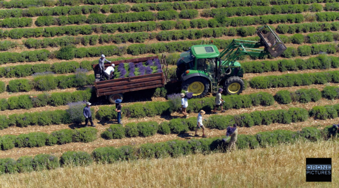
Aerial view by drone of manual harvest of Lavender in a field on Sault plateau, Vaucluse, France © Drone-Pictures
July 1st: Like a perfume of Provence: between green sunflowers in Pierrerue and lavender fields in Sault.
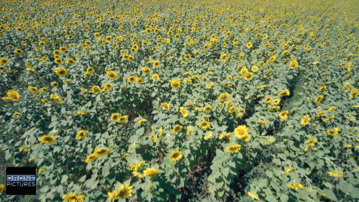
Drone flight over flowering sunflowers on July 16th at Pierrerue near Sault, Vaucluse, France © Drone-Pictures
June 11th: We were on the side of Sault and Ventoux yesterday for a first harvest of aerial images before the lavender flowers bloom. A good Mistral wind gusting at 50/60kmh, but the Inspiration 2 once again surprised us with its resistance and stability.
Drone-Pictures represents the HOsiHO Drone Network in the south of France, and particularly in Provence and on the Côte d'Azur in the following french departments: